Best Road Trips in Cyprus
We were winding through the Troodos Mountains somewhere between Platres and Omodos when the GPS lost signal and the road narrowed to a single lane between stone walls. A woman in a doorway waved us toward a tiny square where three old men sat under a mulberry tree. One of them walked over, looked at our rental car’s Larnaca plates, and in perfect English said, “Lost? Everybody gets lost here. Stay for coffee.” We stayed. The coffee was thick, sweet, and served with loukoumi (Cyprus delight). The man turned out to be a retired schoolteacher who had lived in London for 20 years. He drew us a map on a napkin showing a shortcut to Omodos through a route Google Maps did not know about. That shortcut turned out to be the most scenic 15 minutes of our entire Cyprus trip.
Cyprus is 240 km from tip to tip, which sounds like a morning’s drive. In practice, the Troodos Mountains in the center, the Akamas wilderness in the west, and the winding coastal roads stretch distances into genuine excursions. The motorways are fast and efficient — Larnaca to Paphos takes under 2 hours — but the best driving in Cyprus happens off the motorway, on the B-roads that connect mountain villages and trace the coastline through places the tour buses cannot reach.
Here are four routes that cover the island’s best driving.
Route 1: The Troodos Mountain Circuit
The Troodos range is the heart of Cyprus — literally, it sits in the center of the island — and it feels like a different world from the coast. Pine forests, cherry orchards, stone villages with red-tiled roofs, and Byzantine painted churches (nine of which are UNESCO World Heritage Sites). The circuit loops through the mountains from Limassol, climbing to the 1,952-meter summit of Mount Olympus and descending through wine villages back to the coast.
Route Details:
| Segment | Distance | Driving Time | Highlights |
|---|---|---|---|
| Limassol - Platres | 40 km | 50 min | Gradual climb through vineyards |
| Platres - Troodos Square | 12 km | 20 min | Dense pine forest, Caledonia Waterfall trailhead |
| Troodos Square - Mount Olympus | 5 km | 10 min | Summit access road, radar domes, views |
| Troodos - Kakopetria | 25 km | 35 min | Descent through Marathasa Valley |
| Kakopetria - Galata - Kalopanayiotis | 15 km | 25 min | UNESCO painted churches cluster |
| Kalopanayiotis - Kykkos Monastery | 30 km | 45 min | Remote mountain road, dense cedar forest |
| Kykkos - Prodromos - Omodos | 40 km | 55 min | Return through wine country |
| Omodos - Limassol | 40 km | 45 min | Descent through Commandaria region |
Total circuit: 207 km, 5-6 hours driving (full day, or 2 days with overnight in Kakopetria or Kalopanayiotis)
Key Stops on the Troodos Circuit
Platres: The traditional mountain resort village at 1,150 meters elevation, historically favored by British colonial officials escaping the summer coastal heat. The village center has trout restaurants, souvenir shops, and the trailhead for the Caledonia Waterfall walk (3 km round trip, easy terrain, leads to a 12-meter cascade into a natural pool). Trout served fresh at the restaurants: 12-18 EUR for a full meal. The water here is visibly cold and clean enough that the local fish farming industry has been operating without difficulty for decades.
Mount Olympus Summit (1,952 m): The highest point in Cyprus. In winter, there is a small ski resort with four lifts — modest by Alpine standards, but genuinely functional for the scale of the Cypriot winter. In summer, the summit area has nature trails with views across the entire island. On clear days in autumn, the Turkish mainland is visible 70 km to the north as a dark line above the sea. The radar domes at the summit are a British military installation that has been there since the Cold War.
Kakopetria: A preserved stone village in the Solea Valley with a UNESCO-listed church. Agios Nikolaos tis Stegis (St Nicholas of the Roof, named for its protective outer roof over the Byzantine dome) contains frescoes from the 11th to 17th centuries — layered art history in a single small church building. Entry to the church is free; it is managed by the Department of Antiquities and has specific opening hours (confirm before arriving). The old quarter of Kakopetria has narrow streets and stone houses that feel genuinely 18th-century.
The Painted Churches cluster (Galata and Kalopanayiotis): The UNESCO designation covers nine churches in the Troodos Mountains. Galata has four within the village (Agios Sozomenos, Archangelos, Panagia Podithou, Panagia tis Theotokos). Kalopanayiotis has Agios Ioannis Lampadistis — a monastery complex with frescoes from multiple periods including a rare 15th-century Latin chapel added by the Lusignan Crusader rulers. Budget 1-2 hours for the Kalopanayiotis monastery complex alone.
Kykkos Monastery: The wealthiest, most powerful, and most visited monastery in Cyprus, founded in the 11th century and rebuilt several times after fires. The icon of the Virgin Mary here is attributed to Saint Luke and has been kept veiled for centuries (it is said that no mortal eye may look upon it directly). The monastery complex is impressive regardless of religious orientation: gilded mosaics covering every surface of the newer building, courtyards and bell towers, a museum with Byzantine manuscripts and liturgical objects (approximately 5 EUR). Archbishop Makarios III, Cyprus’s first president, is buried at the nearby Throni hilltop.
Omodos: The most visited wine village on the circuit. The central cobblestone square, the Monastery of the Holy Cross (which claims to hold a relic of the True Cross), and a cluster of wine cellars offering tastings define the stop. Commandaria wine — Cyprus’s sweet dessert wine with a documented history since 1191 — is the thing to try here. A good bottle from a village cellar: 8-15 EUR. Most tastings are free if you buy. The local orange-blossom distilled spirit (zivania) is also offered, and we recommend modest quantities.
Car choice note: A standard compact car handles all paved Troodos routes without difficulty. For Cedar Valley (a detour off the main circuit involving an unpaved section) and some off-road side tracks, a 4x4 is recommended. Most rental agency agreements prohibit unpaved road driving — verify before choosing the Cedar Valley detour.
Best time: April-June and September-November. Avoid mid-summer for Troodos mountain drives if you want to see the villages at anything below tourist capacity. The spring wildflower coverage (April-May) and the autumn harvest period (September-October) are the best seasons.
Route 2: Paphos to Akamas Peninsula
The Akamas Peninsula is the wild west of Cyprus — a protected national park on the island’s northwestern tip where the landscape turns rugged, the beaches are empty, and the roads become tracks. This route combines the Paphos coast with the Akamas wilderness for a day of dramatic contrast.
Route Details:
| Segment | Distance | Driving Time | Highlights |
|---|---|---|---|
| Paphos - Coral Bay | 12 km | 15 min | Popular beach, good swimming |
| Coral Bay - Sea Caves (Pegeia) | 8 km | 15 min | Coastal limestone erosion features |
| Coral Bay area - Lara Beach (4x4) | 15 km | 25 min | Turtle nesting beach, unpaved track |
| Return to main road - Polis | 35 km | 45 min | Chrysochou Bay coastal views |
| Polis - Latchi | 3 km | 5 min | Fishing harbor, seafood restaurants |
| Latchi - Baths of Aphrodite | 10 km | 15 min | End of the main paved road |
| Baths of Aphrodite area - hike | — | 30-90 min | Aphrodite Trail and Adonis Trail |
| Return Polis - Paphos (via Laona villages) | 40 km | 50 min | Wine villages, vineyard scenery |
Total paved distance: ~115 km. Additional 15 km unpaved (Lara Beach track, requires 4x4).
The Akamas Off-Road Question
The unpaved jeep tracks in the Akamas are explicitly prohibited by most rental car agreements. The tracks are rough, rocky, and can damage vehicles with low ground clearance. Options:
- Rent a 4x4 from an agency that permits off-road driving. Several local agencies in Paphos offer this explicitly — ask specifically when booking, because standard agencies will not permit it.
- Book a jeep safari. Local operators run guided Akamas tours from Paphos for approximately 60-80 EUR per person. You get a knowledgeable guide and the operator takes responsibility for track conditions.
- Drive the paved sections and hike. The Aphrodite Trail (7.5 km loop from the Baths of Aphrodite) and the Adonis Trail (7.5 km from the same starting point) reach many of the Akamas interior viewpoints on foot. Both trails are well-marked and suitable for average fitness.
Key Stops on the Akamas Route
Coral Bay: A wide, sandy bay 12 km north of Paphos with calm water suitable for swimming. Beach bars, sunbed rental (8-10 EUR), and facilities. Parking lot: approximately 3 EUR. This is the most developed beach near Paphos and acts as a natural first stop before the road quality changes.
Sea Caves (near Pegeia): A few kilometers north of Coral Bay, coastal erosion has carved dramatic arches, tunnels, and caves into the limestone cliffs. Accessible by a short scramble from roadside pullouts. Free, no facilities, but visually striking. Particularly photogenic in the morning light.
Lara Beach (4x4 track): A remote beach that serves as a nesting site for loggerhead (Caretta caretta) and green (Chelonia mydas) sea turtles. June-August is the nesting season; sections of the beach are roped off by the Fisheries Department to protect nests. The beach has no facilities at all — no water, no shade beyond what a few carob trees provide, no food. Bring everything you need. The track to reach it requires a 4x4 and takes approximately 20-25 minutes each way on rock-strewn terrain.
Polis and Latchi: Polis is a small town on Chrysochou Bay that functions as the service center for the Akamas region. Restaurants, supermarket, fuel station (fill up here before continuing to the Baths). Latchi, 3 km further, is a small fishing harbor with several fish tavernas along the quay. A late lunch of fresh grilled fish and local wine at a Latchi taverna (15-22 EUR per person) is one of the better experiences the western Cyprus coast offers.
Baths of Aphrodite: Where the goddess of love supposedly bathed. In reality, it is a shaded grotto with a natural spring pool dripping into a rock basin. The 15-minute walk from the parking lot passes through a botanical garden with labeled native Cypriot plants. The grotto itself is beautiful — mossy, cool, and entirely out of character with the sunburned landscape around it. Free entry.
Laona Villages (return route through the interior): The villages of Droushia, Ineia, Kathikas, and Pegeia in the hills above the Akamas coast are traditional wine-growing communities. Kathikas in particular has several good tavernas and a few cellars offering Vasilissa wine (from local vineyards). A mezze lunch in a village taverna — 12-15 small dishes including hummus, grilled halloumi, village sausages, salads, and bread — runs 15-22 EUR per person. This is some of the best traditional Cypriot cooking outside the main cities.
Route 3: Larnaca to Paphos Coastal Drive
This is the practical route that most visitors drive at least once — the southern coast connecting Cyprus’s two main airports. We recommend taking the motorway one direction and the old B roads the other for maximum variety. The motorway (A6/A1) takes 1.5 hours. The old coastal road (B6 from Limassol to Paphos, and combinations of local roads from Larnaca) takes 3-4 hours with stops.
Route Details (with stops):
| Segment | Distance | Driving Time | Highlights |
|---|---|---|---|
| Larnaca - Kourion (via A1 motorway) | 95 km | 1 hour | Fast transit, exit for ruins |
| Kourion archaeological site visit | — | 1-2 hours | Greco-Roman amphitheater, mosaics |
| Kourion - Kolossi Castle | 12 km | 15 min | Crusader castle, wine history |
| Kolossi - Limassol old town | 10 km | 15 min | Marina, old quarter, lunch options |
| Limassol - Governor’s Beach (via B1) | 20 km | 25 min | White chalk cliffs, dramatic scenery |
| Governor’s Beach return - Paphos (via B6 coast) | 90 km | 1.5 hours | Petra tou Romiou, coastal tavernas |
| Paphos - Tombs of the Kings visit | — | 1-2 hours | UNESCO underground tombs |
Total: ~230 km, 4-5 hours driving plus visits (full day)
Key Stops on the Coastal Drive
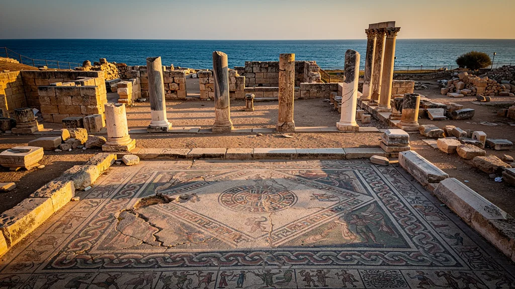
Kourion (Curium): One of the most dramatically sited archaeological sites in the entire Mediterranean, not just Cyprus. The Greco-Roman amphitheater sits on a cliff edge 70 meters above the sea, with views across Episkopi Bay that make the marble seating even more photogenic. Performances are still held here in summer — the acoustics work. The House of Eustolios (Christian complex, 5th century) has some of the finest floor mosaics in Cyprus. The nearby stadium ruins extend along the clifftop. Entry: approximately 4.50 EUR. Allow 2 hours minimum.
Kolossi Castle: A 15th-century Crusader castle built by the Knights Hospitaller (Knights of St John) during their period of Cyprus control. Square tower, three stories, well-preserved. The surrounding agricultural area has been producing Commandaria wine for 800+ years — the name Commandaria itself derives from the “grande commanderie” of the Knights. Entry: approximately 2.50 EUR.
Governor’s Beach: One of the most visually unusual beaches in Cyprus — stark white chalk cliffs contrasting with dark volcanic pebbles in the water. No sand, but the geology is extraordinary. Free parking, free access. Small tavernas on the clifftop serve food and cold drinks. Swimming is possible where the pebbles give way to the clear water.
Petra tou Romiou (Aphrodite’s Rock): On the B6 between Limassol and Paphos, the legendary birthplace of Aphrodite is a dramatic stack of rocks rising from the sea. The mythology: Aphrodite was born from sea foam, which formed here. The reality: a striking geological feature with a pebble beach and a clifftop viewing area with a gift shop. Swimming is possible but currents around the rocks can be strong. Entry to the site is free; parking is 2 EUR.
Paphos Archaeological Park (Paphos Mosaics): A UNESCO World Heritage Site within Paphos town, containing Roman floor mosaics in the Houses of Dionysus, Orpheus, Theseus, and Aion. The mosaics are exceptional — complex mythological scenes preserved under protective shelters, dating to the 2nd-5th centuries AD. This is one of the finest Roman mosaic collections in the world outside of Tunis. Entry: approximately 4.50 EUR. Allow 1.5-2 hours.
Tombs of the Kings: Underground burial complex on the coast north of Paphos, dating to the 4th-3rd centuries BC. Despite the name, these were tombs of wealthy citizens rather than actual royalty — the grandeur of the carved stone chambers, with columns and elaborate facades, explains the misleading name. Eight tomb complexes are accessible. Entry: approximately 2.50 EUR.
Route 4: Commandaria Wine Route
Cyprus has been making wine for over 5,000 years, and the Commandaria region in the southern Troodos foothills is the oldest named wine in the world with continuous production since at least 800 BC. Richard the Lionheart documented the wine in 1191 (and reportedly declared it “the wine of wines”). This short circuit connects the key wine villages in a concentrated half-day or full-day loop that delivers a dose of rural Cyprus most tourists miss entirely.
Route Details:
| Segment | Distance | Driving Time | Highlights |
|---|---|---|---|
| Limassol - Erimi (Cyprus Wine Museum) | 15 km | 20 min | 5,000 years of wine history |
| Erimi - Kolossi Castle | 5 km | 10 min | Crusader castle and wine history junction |
| Kolossi - Laneia village | 20 km | 30 min | First wine village, steep climb |
| Laneia - Lofou | 8 km | 15 min | Restored stone village |
| Lofou - Vouni | 5 km | 10 min | Donkey sanctuary, organic winery |
| Vouni - Omodos | 12 km | 20 min | Main wine village, monastery |
| Omodos - Vasa | 5 km | 10 min | Quiet village, Commandaria heartland |
| Vasa - Malia - Zoopigi | 10 km | 20 min | Remote village end-point |
| Return Malia - Limassol (via motorway) | 30 km | 30 min | Fast return |
Total loop: 110 km, 3-3.5 hours driving (half-day to full day depending on tasting stops)
Wine Villages and Tasting Stops
Cyprus Wine Museum (Erimi): Located in a converted medieval house, the museum covers 5,500 years of Cypriot winemaking with exhibits, artifacts (including Bronze Age wine jars), and a tasting session. Entry with tasting of 4-5 wines: approximately 7 EUR. Good orientation before entering the wine villages.
Laneia: A steep-cliffed village with traditional stone architecture largely intact. Less touristed than Omodos and more atmospheric for it. A few cellars sell Commandaria and local table wines directly. The views from the village edge over the valley toward the coast are impressive.
Lofou: A beautifully preserved village that was largely abandoned in the late 20th century and has been slowly repopulating as a heritage destination. Stone buildings, climbing plants, and narrow lanes give it a quality that staged “traditional villages” rarely achieve. Several studios and guesthouses have opened. A good coffee stop.
Vouni Panayia Winery: One of the larger commercial wineries in the region, offering tours and tastings in a modern facility. Tour and tasting of 4-5 wines: approximately 10 EUR. Indigenous varieties including Maratheftiko (red, dense and structured) and Xynisteri (white, crisp and mineral) are featured. Vouni also operates a donkey sanctuary — the donkeys of the Commandaria region were the traditional working animals of the vineyards before mechanization.
Omodos: The most visited wine village in Cyprus. The cobblestone central square, the Monastery of the Holy Cross (which claims to hold a relic of the True Cross and a section of rope used in the crucifixion), and clustered wine cellars giving free tastings make it a natural stopping point. It is also the most touristed, meaning the cellars are professional at handling visitors but the village center can feel crowded in summer. Go for the wine, not the quiet.
Commandaria wine: The drink of this entire region, Commandaria is a sweet dessert wine made from sun-dried Xynisteri (white) and Mavro (red) grapes. The sugar concentration from drying gives it its characteristic richness. Quality varies significantly — the best is complex and nuanced, the worst is merely sweet. Try several from different producers before buying. A good village Commandaria: 8-15 EUR per bottle. The KEO and SODAP commercial versions available in supermarkets are less interesting than the village producers.
Designated driver planning: This is a wine route. Plan accordingly. Options: designate one driver who sticks to very small tastes, buy bottles for later consumption, or stay overnight in one of the villages (several have guesthouses for 40-70 EUR per night). Driving after multiple full tastings on mountain roads is not an abstract risk.
Route Comparison
| Route | Duration | Best Season | Difficulty | Budget (fuel + entries) |
|---|---|---|---|---|
| Troodos Circuit | Full day or 2 days | Apr-Jun, Sep-Nov | Moderate (narrow mountain roads) | 20-40 EUR |
| Akamas Peninsula | Full day | Mar-Jun, Sep-Nov | Hard (off-road sections) | 15-30 EUR + 4x4 cost |
| Larnaca-Paphos Coastal | Full day | Year-round | Easy | 15-30 EUR |
| Commandaria Wine Route | Half day to full day | Sep-Jun | Easy | 15-35 EUR + wine purchases |
Planning Tips
Combine routes for a full week. A practical 7-day Cyprus itinerary:
- Days 1-2: Larnaca area base — Ayia Napa beaches, Choirokoitia, Lefkara lace village
- Day 3: Drive to Paphos via A6 motorway, afternoon Paphos Mosaics
- Day 4: Akamas Peninsula (full day from Paphos base)
- Days 5-6: Troodos circuit from Platres (overnight in mountain village)
- Day 7: Commandaria wine route, return to Larnaca or Paphos for departure
Water and sunscreen year-round. Even in spring and autumn, the Cypriot sun is intense at altitude and in open archaeological sites. Mountain trails and UNESCO church visits provide limited shade.
Download offline maps before leaving home. Mobile coverage in the Troodos Mountains and Akamas is patchy in specific areas. Google Maps offline mode covers all of Cyprus in a single download (approximately 150 MB). The offline maps are particularly important in the Kykkos area and the Akamas interior.
Fill up before mountain drives. The last reliable fuel stations before entering the Troodos interior are Platres (coming from Limassol) and Kakopetria (from the north). Fill up at one of these villages before continuing. Mountain villages may have small stations with limited hours.
Driving times in mountains are always longer than estimated. The GPS says 40 km, 45 minutes. The actual road involves 50 hairpin turns, a village stop for coffee that was unavoidable, and a flock of goats that required patience. Build generous buffers (at least 50%) into any Troodos or Akamas route estimate.
The left-hand driving adjustment: For the first day on the island, avoid immediately taking mountain roads. Use the motorway and flat coastal roads to adjust to left-hand driving before tackling the Troodos hairpins. One day of coastal driving builds enough instinct to manage mountain curves safely.
For driving rules and left-hand traffic tips, see our driving guide. For the cost of all this, check our costs and tips. For airport pickup advice, read our airport rental guide.