Best Road Trips in Montenegro
Montenegro might be one of the smallest countries in Europe, but it packs more dramatic scenery per kilometer than places ten times its size. We have driven countries where you cruise for hours through flat farmland waiting for the landscape to do something interesting. Montenegro is the opposite problem – the scenery is so relentless that you run out of camera storage before you run out of road. The Bay of Kotor alone could justify a rental car. Add in the Tara Canyon, the Durmitor peaks, and the empty Adriatic beaches south of Budva, and you have one of the best compact road trip destinations anywhere.
The entire country is drivable in a day if you are in a hurry, but that would miss the point entirely. These five routes are designed to be savored, with stops that deserve your time and side roads worth the detour.
Route Overview
| Route | Distance | Driving Time | Best Season | Highlights |
|---|---|---|---|---|
| Bay of Kotor Loop | 80 km | 2-3 hours | Year-round | Kotor, Perast, Our Lady of the Rocks |
| Adriatic Coastal Drive | 105 km | 2.5-3.5 hours | May-October | Budva, Sveti Stefan, Ulcinj |
| Durmitor Mountain Circuit | 180 km | 4-5 hours | June-October | Tara Canyon, Zabljak, Black Lake |
| Kotor-Cetinje Serpentine | 35 km | 1-1.5 hours | April-November | 25 hairpins, panoramic views |
| Podgorica to Kolasin & Biogradska | 120 km | 2-3 hours | May-October | Moraca Canyon, Biogradska Gora |
Route 1: Bay of Kotor Loop
| Distance: 80 km | Time: 2-3 hours (with stops, plan a full day) | Difficulty: Easy |
This is the drive that sells most people on Montenegro. The Bay of Kotor is often called the southernmost fjord in Europe – technically it is a submerged river canyon, but the effect is the same. Sheer limestone mountains rise straight from deep blue water, and medieval towns cluster along the shoreline as if placed there by someone with excellent taste.
The route: Start in Kotor and drive counterclockwise around the bay. Head north along the eastern shore through Dobrota and Ljuta, past fishing villages where boats are tied to front doorsteps. Continue to Perast, a town of 350 people and 16 churches that was once a wealthy maritime republic. From here you can take a boat to Our Lady of the Rocks, an artificial island built on a reef with a church dating to 1452.
Continue around the bay through Risan (check the Roman mosaics at the Villa Urbana, a quick 15-minute stop) and on to Herceg Novi at the bay’s entrance. This town has a sunnier, more relaxed feel than Kotor, with fortress ruins, palm-lined promenades, and a clutch of seafood restaurants overlooking the water.
The return along the western shore passes through Bijela and Tivat. If you want to see what money looks like when it parks, Porto Montenegro in Tivat is a superyacht marina that would not look out of place in Monaco.
Best stops:
- Kotor Old Town (UNESCO World Heritage, 1-2 hours minimum)
- Perast waterfront and Our Lady of the Rocks boat trip (45 minutes including boat)
- Risan Roman mosaics (15 minutes)
- Herceg Novi fortresses and lunch (1-2 hours)
- Porto Montenegro for a waterfront coffee (30 minutes)
Road conditions: Good two-lane road the entire way. Some narrow sections along the eastern shore where the road squeezes between buildings and the water. Summer traffic can slow things down considerably – the section between Kotor and Perast gets congested, especially when cruise ships are in port.
Bay of Kotor Loop – Detailed Stops
Kotor Old Town is the anchor of the loop. The medieval walls encircle a tangle of churches, palaces, and marble-paved squares. The Cathedral of Saint Tryphon dates to 1166. Climb the walls (EUR 8 entry) for views over the bay – it is a 30-minute walk to the top. The cat population of Kotor is semi-legendary and has its own museum (the Cats Museum of Kotor, which is exactly as charming as it sounds).
Dobrota is the 3-km stretch of old stone houses between Kotor and Perast that most people drive through without stopping, which is a mistake. This was where Kotor’s wealthy merchant families built their summer residences in the 17th and 18th centuries. The facades along the bay road are some of the finest baroque architecture in the Adriatic.
Perast deserves at least an hour. The town has 16 churches for a population of 350 people, a ratio that suggests either extraordinary piety or very creative use of old buildings. The Venetian baroque palaces line the waterfront, and the Church of St. Nicholas (free entry) has a collection of maritime paintings and ex-votos from centuries of sailors praying for safe passage. The boat trips to Our Lady of the Rocks leave from the small pier – negotiate the price (typically EUR 5-8 per person for the 5-minute crossing), and you have an island church, wooden icons, and embroidery made by a noblewoman who reportedly spent 25 years on the piece.
Risan has the best-kept secret on the loop: a Roman-era villa with remarkably well-preserved floor mosaics (Hypnos, the god of sleep, presides over the main hall). The site is small, often empty of other tourists, and costs almost nothing to enter. Budget 20 minutes.
Herceg Novi at the entrance to the bay is where the loop ends (or begins if you drive clockwise). The city has a pleasant confusion of eras: Ottoman-era Kanli Kula fortress, Austro-Hungarian architecture along the main square, a Spanish-built citadel, and a waterfront boulevard lined with palm trees. The seafood here is cheaper than in Kotor and, in our experience, equally good.
Timing the Loop
The worst time to drive the Bay of Kotor loop is on a cruise ship day between 10 AM and 5 PM, when the roads around Kotor and Perast become one continuous traffic jam. The Kotor port publishes its ship schedule online – check it and plan accordingly. The best times: early morning (leave Kotor by 8 AM) or late afternoon (start the loop at 4 PM when ships are departing).
| Time | Conditions |
|---|---|
| 7-9 AM | Empty roads, golden morning light on the bay |
| 9 AM-5 PM (cruise ship days) | Congested, especially Kotor-Perast |
| 4-7 PM | Crowds thinning, evening light on the water |
| Year-round | Kotor and Perast never fully close; winter is quiet and atmospheric |
Route 2: Adriatic Coastal Drive (Budva to Ulcinj)
| Distance: 105 km | Time: 2.5-3.5 hours | Difficulty: Easy |
If the Bay of Kotor is about dramatic geology, the coastal drive south is about beaches, small towns, and the kind of Mediterranean atmosphere that makes you consider moving here permanently. This stretch of the Adriatic is less developed than Croatia to the north, which means fewer resorts and more character.
The route: Start in Budva, whose old town is a compact Venetian-era citadel surrounded by beaches. Drive south on the E65, and within 10 minutes you will see the islet of Sveti Stefan connected to the shore by a narrow causeway – one of the most photographed spots in Montenegro. The former fishing village is now an Aman resort, but the viewpoint is free and worth the stop.
Continue through Petrovac (a quieter beach town that makes a nice alternative base to Budva), past the monasteries of Rezevici and Gradiste, and along the coast to Bar. Bar has a massive 11th-century fortress (Stari Bar) sitting above the modern town, and the port here runs ferries to Bari in Italy.
The final stretch from Bar to Ulcinj is the wildest part of the coast. Ulcinj itself is an Albanian-majority town with a distinctly different atmosphere – the Old Town is perched on cliffs above the sea, and the 12 km Velika Plaza (Long Beach) south of town is one of the biggest sandy beaches on the Adriatic.
Best stops:
- Budva Old Town (1 hour)
- Sveti Stefan viewpoint (15 minutes)
- Petrovac beach and lunch (1 hour)
- Stari Bar fortress (1 hour)
- Ulcinj Old Town and Long Beach (2 hours)
Road conditions: The E65 is a well-maintained two-lane highway for this entire route. Some winding sections between Budva and Petrovac, but nothing technical. A few short tunnels. Light traffic outside of summer.
Coastal Drive – Detailed Stops
Budva Old Town sits on a small peninsula jutting into the Adriatic, enclosed by Venetian-built walls. Inside, the streets are narrow, the churches are old (the Cathedral of St. John dates to the 7th century, destroyed by the 1979 earthquake and subsequently rebuilt), and the crowds are considerable in summer. The beaches immediately outside the walls – Mogren Beach, accessible through a short tunnel cut through the rock – are among the most attractive in Montenegro.
Sveti Stefan is possibly the most-photographed spot in the country, and the photos genuinely do not do it justice. The tiny island is connected to the mainland by a narrow sand causeway, and the entire settlement of old stone houses has been converted into the Aman Sveti Stefan resort. Non-guests cannot enter the island, but the viewpoint from the road above (pull over in the designated area) delivers the full picture postcard effect at no cost.
Petrovac na Moru is what Budva was before tourism arrived en masse. The small beach town has a proper medieval tower, a mosaic-floored Roman villa nearby (the Villa Rustika), and a bay lined with pine trees that provides shade even at the height of summer. The restaurant scene on the waterfront is good and notably cheaper than Budva. We have eaten some of our best Montenegrin meals here – fresh-caught fish at tables six meters from the water.
Stari Bar (Old Bar) is the kind of place that historians love and tourists overlook. The medieval fortress city sits on a hillside 4 km from the modern Bar, surrounded by olive trees that are reportedly over 2,000 years old. Inside the walls are the ruins of churches, mosques, hammams, and palaces from successive periods of Venetian, Ottoman, and later control. Entry costs EUR 2. Budget an hour and wear comfortable shoes for the uneven stone paths.
Ulcinj is different from anywhere else in Montenegro. The Albanian cultural influence is everywhere – in the call to prayer from the mosques, in the restaurants serving byrek and tavë kosi, in the music drifting from the coffee houses in the narrow Old Town streets. The Old Town itself climbs a cliff above the harbor, with a fortress that has been Venetian, Ottoman, and briefly the base of Cervantes (he was imprisoned here after his capture by pirates). The long beach (Velika Plaza, 12 km of uninterrupted sand) is the best sandy beach in Montenegro and gets genuinely good surf conditions in autumn.
| Stop | Distance from Budva | Drive Time | Entry Cost |
|---|---|---|---|
| Sveti Stefan viewpoint | 9 km | 15 min | Free |
| Petrovac na Moru | 25 km | 35 min | Free |
| Rezevici Monastery | 30 km | 40 min | Free |
| Stari Bar | 60 km | 1 hr | EUR 2 |
| Ulcinj Old Town | 80 km | 1 hr 20 min | Free |
| Velika Plaza | 93 km | 1 hr 35 min | Free |
Route 3: Durmitor Mountain Circuit
| Distance: 180 km (from Zabljak as base) | Time: 4-5 hours driving, full day with stops | Difficulty: Moderate to challenging |
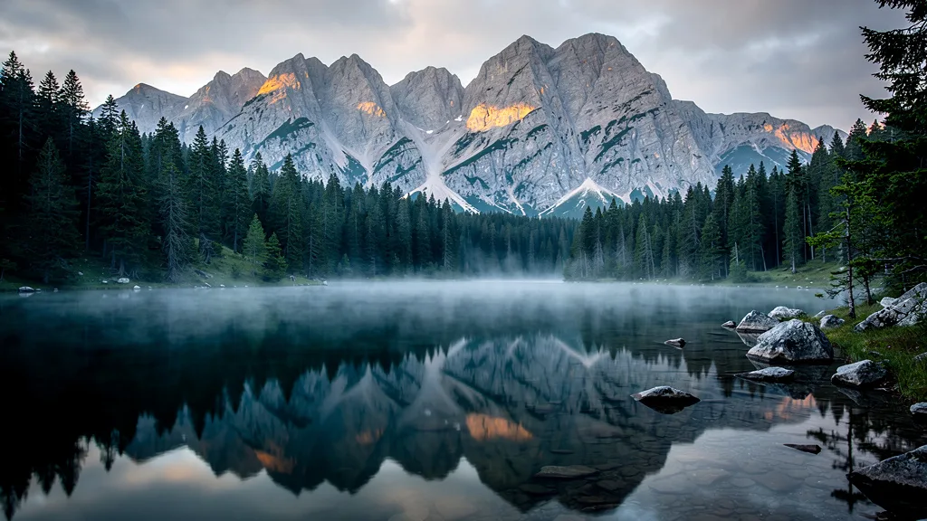
Durmitor National Park is where Montenegro’s mountains get serious. Peaks above 2,500 meters, glacial lakes, the deepest canyon in Europe, and forests that look like they have been undisturbed for centuries. This circuit covers the most accessible highlights, but you could spend a week here and still find new roads to explore.
The route: Base yourself in Zabljak, the small mountain town that serves as Durmitor’s gateway. Start with the drive to Tara Bridge (Djurdjevica Tara Bridge), a 365-meter-long concrete arch that spans the Tara Canyon at a height of 172 meters. The bridge was built in 1940 and partially destroyed in WWII to prevent Italian advance – the engineer who designed it was the one who detonated it. It was rebuilt after the war and remains one of the most dramatic bridges in Europe.
From the bridge, continue along the canyon road toward Mojkovac, a route that hugs the edge of the Tara Canyon with sheer drops and dense forest. At Mojkovac, turn west and climb back toward Zabljak through Savnik and Niksic – this longer loop takes you through less-visited mountain scenery.
Closer to Zabljak, drive to Black Lake (Crno Jezero), a glacial lake 3 km from town that sits at the base of Medjed peak. The short walk around the lake (3.6 km, 1 hour) is one of the most popular hikes in Montenegro for good reason.
Best stops:
- Tara Bridge viewpoint (30 minutes)
- Tara Canyon overlooks along the road (multiple stops)
- Black Lake walk (1-1.5 hours)
- Zabljak town for lunch (charming, unpretentious, good food)
- Durmitor Ice Cave (if time allows, 2-hour hike from Zabljak)
Road conditions: The road from Zabljak to Tara Bridge is paved but narrow with sharp curves. The canyon road to Mojkovac is more demanding – steep gradients, no guardrails in places, and occasional rockfall debris. The road surface is adequate but not pristine. This route is best driven in daylight and not recommended in wet weather or winter. An SUV or car with decent ground clearance is helpful but not essential for a standard sedan.
Durmitor Circuit – Detailed Stops
Zabljak (population ~3,000) sits at 1,456 meters – the highest town in the Balkans. In summer it is a gateway for hiking, rafting on the Tara River, and mountain biking. In winter it serves as Montenegro’s primary ski resort (Durmitor ski center has 12 km of piste and is unpretentious but genuinely snowy). The town itself is not beautiful in the traditional sense, but it functions well as a base. The Balkanska Street has good restaurants serving lamb spit-roast (jagnjetina), locally cured meats, and kacamak (polenta with cheese and sour cream that tastes much better than it sounds).
Tara Bridge (Djurdjevica Tara) spans the deepest river canyon in Europe at a height of 172 meters. The statistics are impressive; the view is more so. From the walkway along the bridge, you look down into a canyon 1,300 meters deep, with the Tara River a green thread far below. The bridge is free to walk across, and the viewpoint at the end is one of the most vertiginous moments available by car in the Balkans. The nearby tourist complex also runs bungee jumping off the bridge for those who find merely standing on it insufficiently exciting.
Tara Canyon is a UNESCO World Heritage Site and the deepest river canyon in Europe (and the second deepest in the world after the Grand Canyon). The canyon rim road offers several formal viewpoints and dozens of informal pullouts where you can stop and peer into the abyss. Rafting the Tara is a popular multi-day activity (typically 2-3 days for the full canyon) – we have done a day section from Brstanova to Scepan Polje and it is spectacular. If you only have a day, the canyon viewpoints from the road deliver most of the visual impact without getting wet.
Black Lake (Crno Jezero) sits in a glacial cirque 3 km from Zabljak center and is connected to the town by a simple road. The lake is actually two lakes (Veliko and Malo Crno Jezero, Big and Small Black Lake) connected by a channel, surrounded by dense black pine forest. The circuit walk around both lakes (about 3.5 km, easy terrain, 1 hour) ranks among the most pleasant short walks in the Balkans. Entry to the National Park costs EUR 3 per person (paid at the kiosk at the road entrance). Park right at the lake – there is a lot specifically for it.
| Feature | Detail |
|---|---|
| Tara Canyon depth | 1,300 meters (deepest in Europe) |
| Tara Bridge height | 172 meters |
| Tara Bridge length | 365 meters |
| Black Lake elevation | 1,416 meters |
| Black Lake circuit | 3.5 km, 1 hour |
| Zabljak elevation | 1,456 meters |
| Durmitor highest peak | Bobotov Kuk, 2,523 meters |
| National Park entry | EUR 3 per person |
Route 4: Kotor-Cetinje Serpentine
| Distance: 35 km | Time: 1-1.5 hours | Difficulty: Moderate (steep switchbacks) |
This is Montenegro’s most famous road, and it earns its reputation. The serpentine climbs from Kotor at sea level to the Krstac pass at about 1,000 meters via 25 numbered hairpin turns. Each turn delivers a wider panorama of the bay below, and by the time you reach the top, the view stretches across the entire Bay of Kotor with the Adriatic glittering beyond.
The route: Start at the eastern edge of Kotor Old Town and follow signs to Cetinje. The serpentine road (P1) begins climbing immediately, with each switchback marked by a numbered stone marker. The road is paved and in reasonable condition, but narrow – two cars can pass, but not comfortably. The gradient is steep enough that you will be in second or third gear for most of the ascent.
At the Krstac pass, there is a parking area and the old Austrian-era fortress with panoramic views. This is the best viewpoint on the entire route and worth a 20-minute stop.
Continue downhill to Cetinje, the old royal capital of Montenegro. It is a quiet, dignified town of palaces-turned-museums, embassies from the era when Montenegro was a kingdom, and tree-lined boulevards. The contrast with the coastal bustle of Kotor could not be more stark.
Best stops:
- Hairpin viewpoints (stop at turns 10, 15, and 22 for the best angles)
- Krstac pass fortress and panorama (20 minutes)
- Cetinje old royal palace and monastery (1 hour)
Road conditions: Paved but narrow, with steep grades and tight switchbacks. Uphill traffic has right of way. Use your horn before blind turns. Not recommended for very large vehicles or nervous drivers. The road can be icy in winter and closed during heavy snowfall. In summer, this is a popular route and you will share it with tour buses, which makes passing interesting.
Serpentine Road – Tips and Details
Driving direction: Most people drive this road from Kotor up to Cetinje, which gives you the most dramatic experience of the views opening progressively as you climb. The downhill return is equally scenic but requires careful braking on the steep grade – do not ride your brakes continuously or you will overheat them.
Tour bus encounter protocol: This road is on every tour bus itinerary in Montenegro. Buses come down from Cetinje in the morning (to Kotor to meet cruise ships) and return in the afternoon. If you are going up and encounter a bus coming down, one of you is pulling into a wider section. Usually it is you. Be prepared for this.
Photography: Numbered stone markers show which hairpin you are on. Turns 10, 15, and 22 have the widest viewing angles back over the bay. Pull completely off the road before stopping – the road is too narrow to pause in the lane without causing a problem.
Cetinje: The former royal capital deserves more than a quick turnaround. The town’s museums include the State Museum of Montenegro in the former royal palace, with exhibits on the history of the Montenegrin kingdom. The Cetinje Monastery (rebuilt 1785) houses what is claimed to be a relic of the hand of Saint John the Baptist. The Biljarda, the palace built by Prince-Bishop Petar II Petrovic-Njegos, has a large relief map of Montenegro made by the Austrian military in the 19th century that is worth seeing. Budget 2-3 hours for the town if you want to do it properly.
Alternative return: Instead of retracing the serpentine, return to the coast via the new tunnel at Krstac (EUR 1.00 toll) and then the Sozina Tunnel (EUR 3.50). This is faster and easier, though you miss the views of the descent.
Route 5: Podgorica to Kolasin via Moraca Canyon
| Distance: 120 km | Time: 2-3 hours | Difficulty: Easy to moderate |
This route follows the Moraca River north from Podgorica through a canyon that few tourists bother to visit, which is their loss. The canyon walls rise 1,000 meters above the river, and the road threads along the bottom with occasional bridges and tunnels.
The route: Leave Podgorica heading north on the E65 toward Serbia. After about 30 km, the road enters the Moraca Canyon and the scenery transforms from the dry lowlands around Podgorica to a green, dramatic gorge. Stop at the Moraca Monastery, a 13th-century Serbian Orthodox monastery with remarkable frescoes, set in a peaceful clearing above the river.
Continue through the canyon to Kolasin, a small mountain town that makes an excellent base for exploring Biogradska Gora National Park. The park contains one of the last remaining primeval forests in Europe – trees over 500 years old, a pristine glacial lake, and walking trails through vegetation that has not been logged in recorded history.
Best stops:
- Moraca Monastery (30 minutes)
- Canyon viewpoints (multiple pullouts along the route)
- Biogradska Gora National Park and lake walk (2 hours)
- Kolasin town for lunch or coffee (30 minutes)
Road conditions: The E65 through the canyon is a well-maintained two-lane highway with good surfaces. Some tunnels and tight curves, but nothing as demanding as the Kotor serpentine or Durmitor roads. This is one of the most pleasant drives in Montenegro – dramatic scenery on a comfortable road.
Moraca Canyon – Detailed Stops
Moraca Monastery was founded in 1252 and survives as one of the finest examples of medieval Serbian Orthodox architecture. The frescoes inside the main church include a cycle of scenes from the life of the prophet Elijah that art historians consider among the most accomplished medieval frescoes in the Balkans. The monastery is still active – monks and nuns live here, the bells ring for services, and the garden is immaculate. Dress appropriately (shoulders and knees covered) before entering. The monastery is free to visit and set in a particularly lovely spot where the canyon widens briefly.
Biogradska Gora National Park protects one of the three remaining primeval forests in Europe (the others are in Albania and Ukraine). The beech trees in the core forest are over 500 years old and create a cathedral-like canopy in summer. The main lake (Biogradsko Jezero) is a 30-minute walk from the park entrance, and the circuit walk around the lake (3.5 km, 1 hour) is among the most peaceful things you can do in Montenegro. Deer and wild boar inhabit the forest, though spotting them requires patience and luck. Entry costs EUR 3 per person (car parking additional EUR 2).
Kolasin is a ski resort in winter and a mountain activities hub in summer. The town center has a pleasant main square with cafes and restaurants, and the food here leans toward hearty mountain fare – lamb stew, corn bread, and the local cheese that comes from the high pastures above town. The skiing at Kolasin 1450 and Kolasin 1600 (two separate resorts on the same mountain) has improved significantly in recent years, with modern lifts and reasonably reliable snowfall from December to March.
| Stop | Distance from Podgorica | Time from Podgorica |
|---|---|---|
| Moraca Canyon viewpoints | 30-50 km | 35-50 min |
| Moraca Monastery | 58 km | 55 min |
| Kolasin | 82 km | 1 hr 20 min |
| Biogradska Gora National Park | 98 km | 1 hr 40 min |
Planning Tips
Car choice: For Routes 1, 2, and 5, any compact car will do fine. For Routes 3 and 4, consider something with a bit more power – the steep gradients can be tiring in a tiny engine. An SUV is not necessary for any paved route but gives you more confidence on the mountain roads.
Timing: Start mountain drives early in the morning, especially in summer. Afternoon thunderstorms in the Durmitor area can be sudden and intense. The Bay of Kotor loop is best started either early (before 9 AM) or late afternoon to avoid cruise ship crowds.
Fuel: Fill up before any mountain route. The coast and Podgorica have plenty of stations, but once you head into the mountains, they become scarce. The stretch from Zabljak to Mojkovac has limited fuel options.
Navigation: Google Maps and Waze work well throughout Montenegro, including mountain routes. Download offline maps for Durmitor and the northern mountains before you leave the coast – 4G coverage is patchy above 1,200 meters elevation. The Maps.me app has good offline maps for Montenegro and is free.
Combining routes: A solid one-week itinerary would be: Day 1-2 Bay of Kotor and Serpentine, Day 3 Coastal drive to Ulcinj, Day 4 Podgorica to Durmitor, Day 5 Durmitor explorations, Day 6 Durmitor to Kolasin and Biogradska Gora, Day 7 Return to coast or airport.
One-Week Road Trip Sample Itinerary
| Day | Route | Distance | Base |
|---|---|---|---|
| Day 1 | Arrive Tivat airport, Bay of Kotor Loop | 80 km | Kotor |
| Day 2 | Kotor Serpentine, Cetinje, Lovcen | 70 km | Budva |
| Day 3 | Coastal drive: Budva to Ulcinj | 105 km | Ulcinj |
| Day 4 | Ulcinj to Podgorica to Zabljak | 250 km | Zabljak |
| Day 5 | Durmitor circuit: Tara Bridge, canyon | 180 km | Zabljak |
| Day 6 | Zabljak to Kolasin, Biogradska Gora | 140 km | Kolasin |
| Day 7 | Kolasin to Podgorica/Tivat airport | 80-120 km | Depart |
For driving rules and conditions, see our Montenegro driving guide. To budget your trip, check rental costs and tips. And for broader trip planning advice, our road trip planning guide covers the essentials.